Alleviating Flooding: Controlled Drainage legal ditch Systems
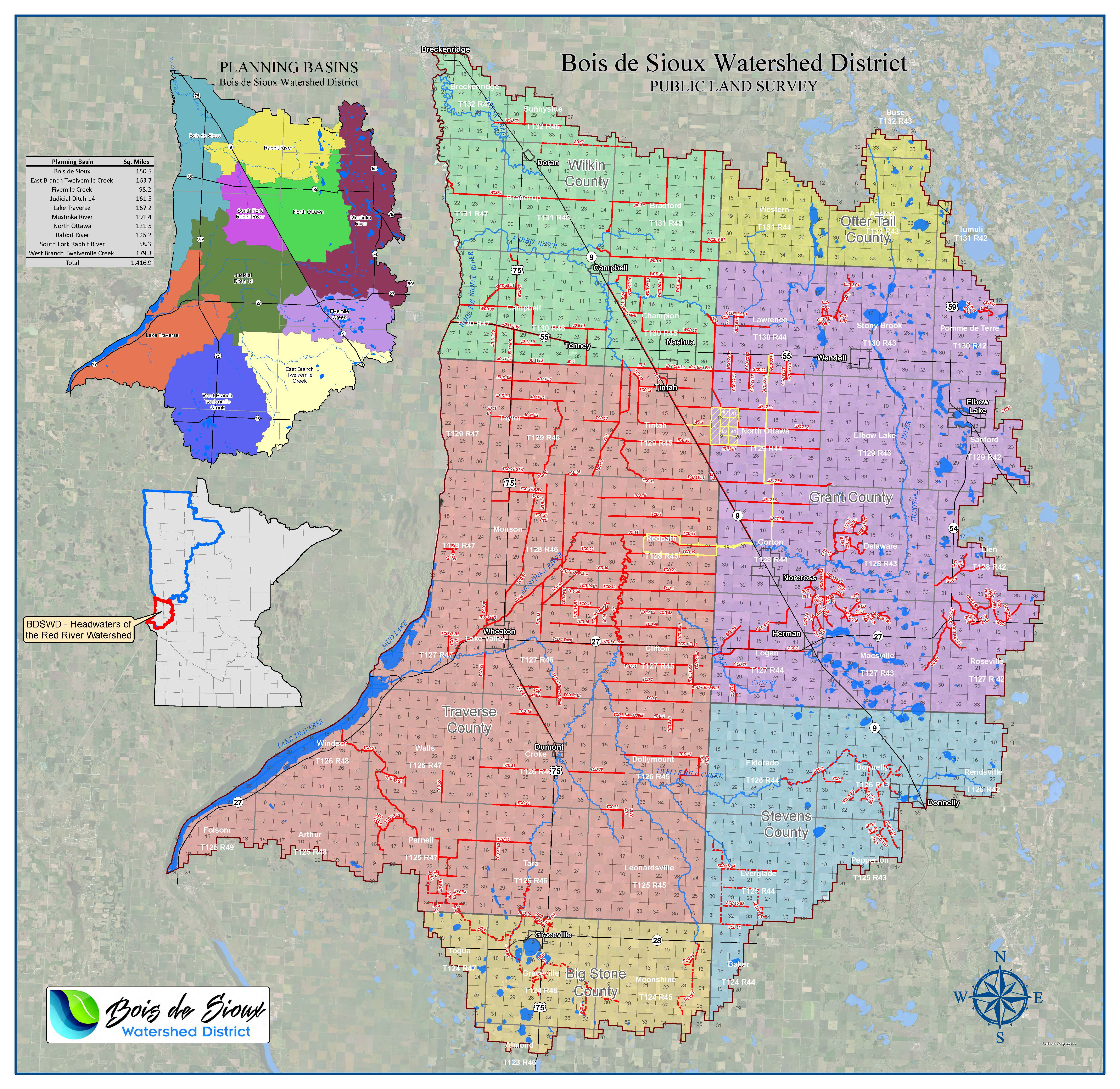
The Bois de Sioux Watershed District utilizes legal drainage systems (authorized and governed under Minnesota Statute Chapter 103E) to manage water flows. The Bois de Sioux Watershed District serves as the legal ditch authority for some 103E drainage systems in Grant and Wilkin Counties, and all 103E drainage systems in Traverse County. A large map is available here. Modernized drainage systems are important for our flat topography. Drainage systems provide storage of excess flows and culvert sizing can be used to meter flows.
In addition to permitting activities within drainage systems, the Bois de Sioux Watershed District maintains a three year schedule for inspection of the drainage systems under the District's authority.
Even during times of excess precipitation, waterflow is controlled by roads and culvert sizing. In cases where the amount of rain exceeds what the soil can hold, drainage ditches will fill to their engineered capacity, and excess water is stored in adjacent property. It is a common goal of the 1998 Mediation Agreement (signed by the MN Department of Natural Resources, Red River Watershed Management Board, National Audubon Society, Minnesota Center for Environmental Advocacy, US Army Corps of Engineers, Board of Water and Soil Resources, US Fish & Wildlife Service, Minnesota Pollution Control Agency), that we work towards protection against a ten-year summer storm event for farmland. Most of the drainage ditches constructed in our region do not yet meet this capacity.
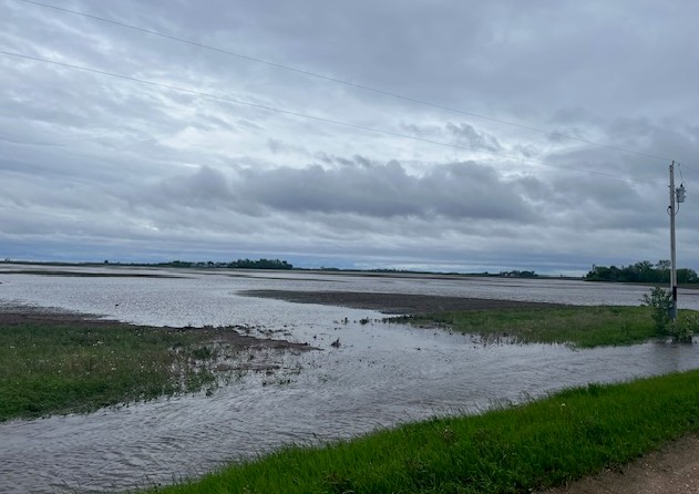
Above: A landowner loses a portion of his crop due to excess rains and inadequate drainage systems, following a post-planting precipitation event. A joint agreement in the Red River Valley was entered into to accelerate construction of updated drainage systems by government units and environmental organizations.
Maintenance on a drainage system may be identified during and ordered after an inspection, or requests may be brought from landowners. Maintenance activities are considered on a case-by-case basis, and maintenance decisions include consideration of ditch fund balances.
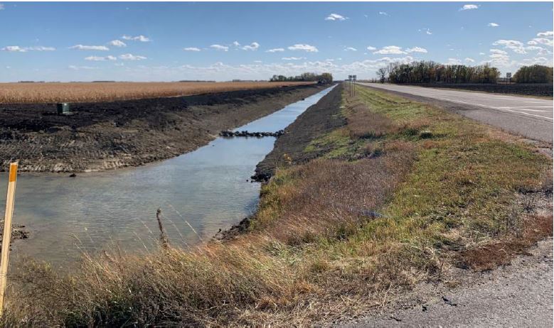
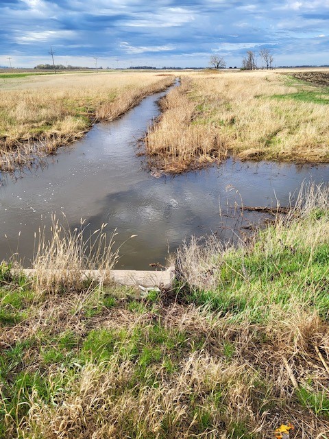 Above: A muddy public water (left) meets the clear waters of controlled drainage (right).
Benefits of drainage: protect road and bridge infrstracture; provide warmer, drier conditions for planting; protect soil and microbes from excessive waterlogged conditions; salinity control; improved plant root health; increased plant resiliency; delayed and reduced surface runoff volumes; reduced loses of sediment, phosphorus, and ammonium-nitrogen.
To learn more about conservation drainage practices, please watch this U of M presentation hosted during a Minnesota Clean Water Council Policy Committee meeting.
Bois de Sioux Watershed District Follows Shared Red River Basin Surface Drainage System Technical Design Standards
The Bois de Sioux Watershed District is a member of the Red River Watershed Management Board, representing a committment to support a basin-wide comprehensive surface drainage management strategy that includes:
1) Uniform Surface Drainage Design: Agreed upon technical standards for design guidance are considered when permitting or improving both public and private surface drainage systems in agricultural areas of the Red River Basin.
2) Flood Storage: Flood storage can also further reduce flood damages in drainage systems where the design guidance is applied. Although there are many types of floodwater storage, the most effective are those with “gated” outlet structures that are strategically located and have the capacity to store floodwaters until they can be released without adding to flood damages downstream. Gated storage is preferred over ungated storage.
3) Maintain Non-Contributing Areas: Drainage of noncontributing areas should be discouraged wherever possible. If non-contributing areas are drained, other strategies to mitigate the additional downstream flow contribution (e.g. temporary floodwater storage) from these areas must be implemented to mitigate any downstream impacts from the additional water added to the flood hydrograph.
4) Subsurface Drainage Management: The RRWMB reaffirms the subsurface management recommendations to mitigate flood impacts from subsurface drainage systems including the installation and operation of controls to increase temporary storage during flood events whenever possible (BTSAC 2012).
The Basin Technical and Scientific Advisory Committee (BTSAC) Briefing Paper #3: Water Management Options for Surface Drainage was developed by a collaborative team and is available here. Additional technical standards utilized by the Bois de Sioux Watershed District can be found here.
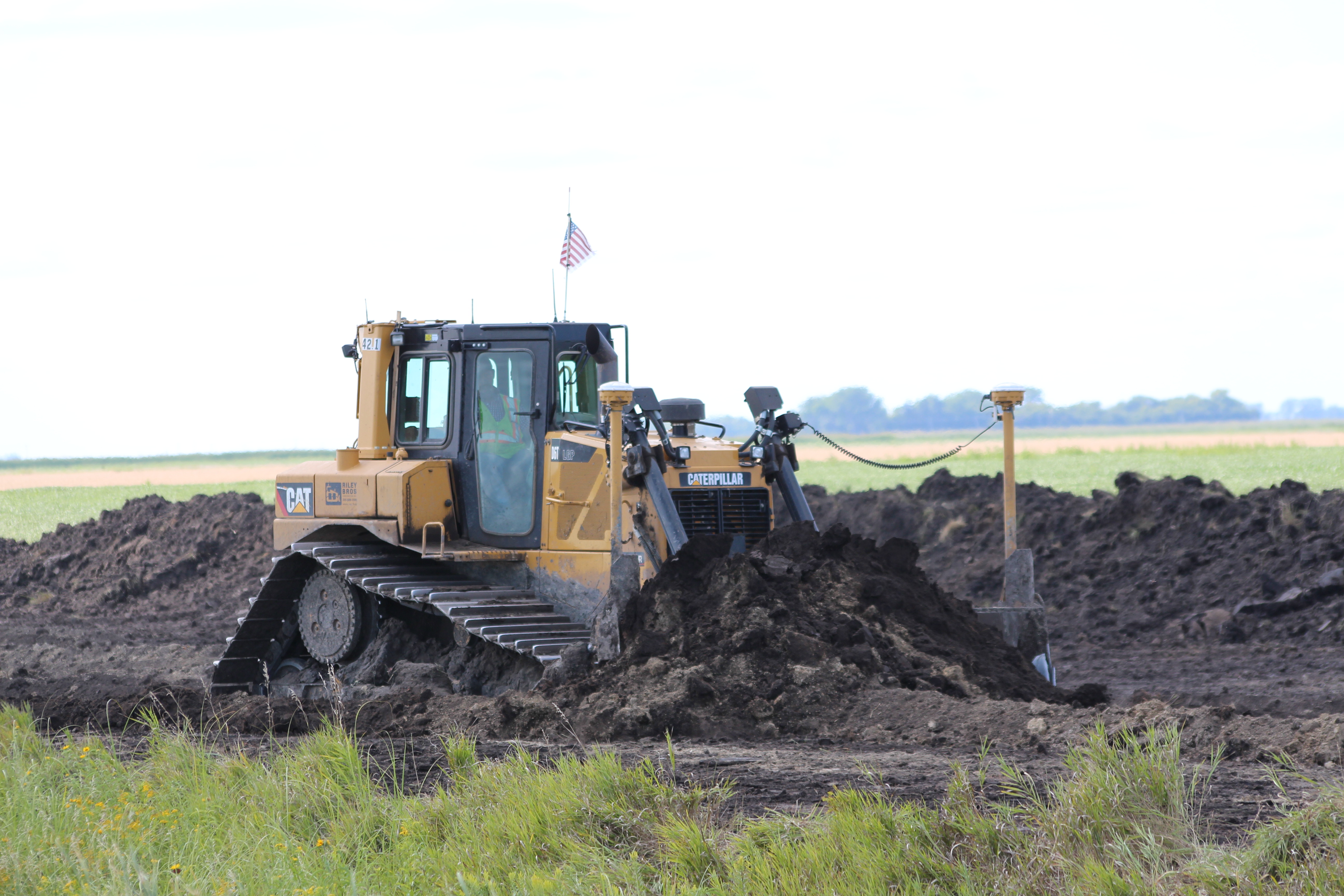
Beyond routine maintenance: Retrofits, Improvements, and Systemwide Repairs
Bois de Sioux & Mustinka Watersheds: Entering a 9th Year of Aggressive Water Quality Improvement Projects
Landowners and agricultural producers are working voluntarily to reduce sediment in the Bois de Sioux and Mustinka Watersheds in West Central Minnesota. Over the past decade, projects on farmland and throughout small drainage areas have helped to reduce erosion, reduce flooding, and improve water quality. These projects require several years to plan and design, and are a collaborative effort: landowners, counties, SWCD's, and the Bois de Sioux Watershed all play important, integral roles.
Larger projects may be initiated by landowners, and financing may be supported by the Bois de Sioux Watershed District (for systems under its authority) and corresponding county (who can secure general obligation bonds).
District Culvert Sizing Cost Share Program
District Clean Water Cost Share Program
Please contact our office if you are interested in inititiating these proceedings. Public notices and hearings related to drainage system proceedings are posted to the District's Public Meeting, Hearing, and Notices webpage.
These projects achieve progress towards many of the District's One Watershed One Plan goals, including: nutrient loading, public ditch system inadequacy, public ditch system instability, private flooding, public flooding, soil health, erosion and sedimentation.
2022-2023 Multipurpose Drainage Management Retrofit Project: TCD #35.In preparation for the Redpath Flood Impoundment and Mustinka River Rehabilitation, Traverse County Ditch #35 (TCD #35) had to be moved - moving the drainage system provided an opportunity to add design enhancements that improve water quality. Grade stabilization structures/side inlet culverts and continuous berms qualify for grant funding through the Legacy Act Clean Water Fund BWSR Projects and Practices Grant.
Please watch this video showcasing 2022 construction: https://youtu.be/FW2X7M1NwoQ:
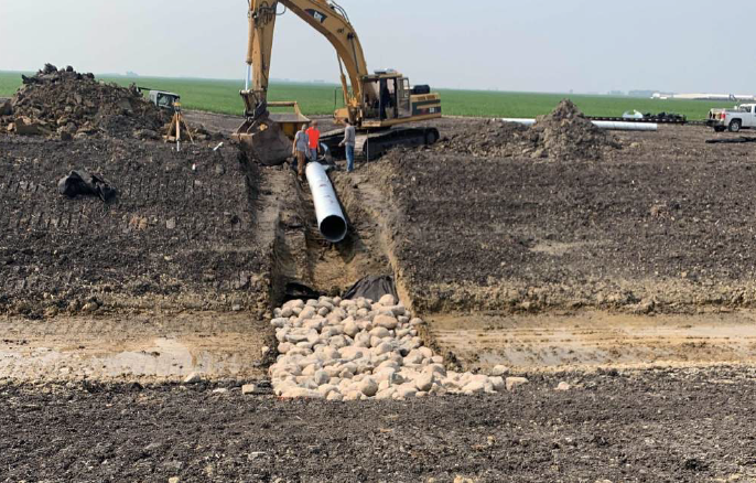
2023 Construction : Wilkin County Ditch #Sub-1. Wilkin County Ditch #Sub-1 is located in Brandrup Township, west of Highway 75. The system was found to be out of repair due to the accumulation of sediment, with approximately 1 - 2 feet of sediment deposition throughout much of the channel extents.
The proposed project is designed for a 10-year precipitation event, which is just under 4” in 24 hours in this location. The proposed project will not be deeper than the original ditch at the outlet. From the outlet, the proposed grade line will have a flatter profile, causing the grade line to gradually become deeper than the original grade line moving upstream. The proposed cross section of the ditch system adjusts the side slopes from 2.5:1 to flatter 3:1 and 4:1 slopes. This change will result in a slightly more cross-sectional area of the channel and, along with the flatter profile, will result in reduced velocities and less chance for in-channel erosion. Side inlet culverts are included in the project, but locations will be finalized on-site with landowners during construction.
Engineering started the design by looking at the outlet, to ensure the proposed project would not worsen a current condition. Then design features encourage the project area to function as an integrated system. The proposed channel is larger at the outlet to handle the cumulative flow, and the channel becomes smaller as it makes its way upstream, to handle less cumulative flow. Overall, the proposed design will equalize breakouts, as much as possible, with the goal that water inundation during larger events will leave the system equally at points upstream, mid-stream, and downstream. A drop of in-channel water elevation will be realized by the widening and deepening of the channel. District Engineer Chad Engels stated that, although the proposed project is not designed to mitigate large flood events, WCD #Sub-1 is located in an “early water” zone of the District and runoff from this location is generally ahead of the flood crest at Breckenridge.
In response to the water quality benefits that this project provides, the Board of Soil and Water Resources provided a $244,150 Clean Water Multi-Purpose Management Grant and $370,000 Clean Water Watershed Based Implementation Fund grant allocation.
Progress Towards Measureable Goals:
- Reduce Sediment by 90 tons/year
- Increased Buffer Easements by 46.15 acres
- Decrease Public Flooding Risk
- Decrease Private Flooding Risk
- Increase Public Ditch Stability by 8 miles
- Decrease Public Ditch System Inadequacy by 8 miles
- Decrease Nutrient Loading Phosphorous by 450 tons/year
2021: Judicial Ditch #6
Judicial Ditch #6 is located North and South of State Highway 55, just east of the former City of Tenney. Although a cleanout was attempted in 2016, the resulting side slopes along the road were found to be 1:5 - 2:1. The side slopes were found to be steeper than other typical ditch systems for the region and do experience some sloughing. The repair consisted of excavating the bottom ditch channel, to the repair grade and construction of 3:1 side slopes. The excavated material was used to construct earthen berms adjacent to the ditch and side inlet culverts were installed to allow the adjacent fields to drain into the ditch systems. These best management practices allow runoff from the field to slow before entering the ditch system, and will allow some sediment to settle in the field (as opposed to within the ditch).
In response to the water quality benefits that this project provides, the Board of Soil and Water Resources provided a $356,359 Clean Water Multi-Purpose Management Grant and $148,000 Clean Water Watershed Based Implementation Fund grant allocation. This project was also supported by a District Culvert Sizing Cost Share award of $318,215.50 and a District Clean Water Cost Share award of $9,212.77.
Progress Towards Measureable Goals:
- Reduce Sediment by 417 tons/year
- Increased Buffer Easements by 44.96 acres
- Decrease Public Flooding Risk
- Decrease Private Flooding Risk
- Increase Public Ditch Stability by 8 miles
- Decrease Public Ditch System Inadequacy by 8 miles
- Decrease Nutrient Loading Phosphorous by 384 tons/year
2020: Judicial Ditch #11
Judicial Ditch #11 is located alongside State Highways 75 and 55. Construction for the repair of Judicial Ditch #11 began Spring 2020. Approximately 60 side inlet structures will be installed, along with 9 miles of continuous berm.
Anticipated water quality impacts to the Bois de Sioux River: sediment load reduction of 420 tons per year, and phosphorous load reduction of 117 pounds per year.
In response to the water quality benefits that this project provides, the Board of Soil and Water Resources provided a $327,00 Clean Water Multi-Purpose Management Grant. This project was also supported by a District Clean Water Cost Share award of $135,645.94.
Progress Towards Measureable Goals:
- Reduce Sediment by 420 tons/year
- Increased Buffer Easements by 95.5 acres
- Decrease Public Flooding Risk
- Decrease Private Flooding Risk
- Increase Public Ditch Stability by 9 miles
- Decrease Public Ditch System Inadequacy by 9 miles
- Decrease Nutrient Loading Phosphorous by 117 tons/year
2019: Wilkin County Ditches #9 & #10
One such project, led locally by landowners in the Wilkin County Ditches #9 & #10 districts, modernized an outdated drainage system. Drainage systems are vital infrastructure because they protect our public roads, highways, bridges, towns, family farms, and even the land itself – removing excess water is important for soil health. Furthermore, existing public drainage systems under the authority of the Bois de Sioux Watershed District are being evaluated for updates that include strategic culvert sizing, floodplain restoration, side-inlet culverts and other erosion and flood mitigation features. This project incorporated all of these features, resulting in cleaner water and reduced flooding. No substantial work has been done to Wilkin County Ditches #9 & #10 since 1910. This project was also supported by a District Culvert Sizing Cost Share award of $332,000, a District Clean Water Cost Share award of $507,056.42 and a base project grant of $100,000 from the Red River Watershed Management Board.
Progress Towards Measureable Goals:
- Reduce Sediment by 569 tons/year
- Increased Buffer Easements by 51.54 acres
- Decrease Public Flooding Risk
- Decrease Private Flooding Risk
- Increase Public Ditch Stability by 7.5 miles
- Decrease Public Ditch System Inadequacy by 7.5 miles
- Decrease Nutrient Loading Phosphorous by 149 tons/year
As stated in the Detailed Survey Report prepared by Moore Engineering, the out of repair system suffered from:
• Uncontrolled flows into the drainage system that cause excessive erosion and sediment transport
• Improper culvert sizing that causes unnecessary flooding and downstream impacts
• Excessive spoil bank heights that force floodwaters over a major highway, posing safety hazard
• High velocity areas that promote channel erosion
“When designed correctly, these projects control water flow and improve water quality” says Bois de Sioux Watershed District Engineer Chad Engels.
Engels believes there is a serious public misconception that agricultural drains cause floods. Engels continues, “The design goal for public drainage system improvements is more complex. The idea is to provide the capacity needed to convey the smaller more frequent summer rainfall events in a manner that results in minimal crop loss. However, larger flows, like those resulting from spring snow melts or heavy summer rain storms, are actually controlled by the project if designed correctly. The secret to the design is to size channels and culverts just large enough to pass the smaller flows. When flows exceed the design flow, excess water is pushed out of the channel and is directed into floodplain storage in adjacent fields. Culvert are used to meter the flow. The most benefit is seen when existing oversized bridges are replaced with smaller culverts.”
In response to the anticipated water quality benefits that this project will provide, the Board of Soil and Water Resources provided a $114,120 Clean Water Multi-Purpose Management Grant in coordination with the Wilkin County Soil and Water Conservation District.
2017: Traverse County Ditch #37. Check-out this press release on Traverse County Ditch #37.